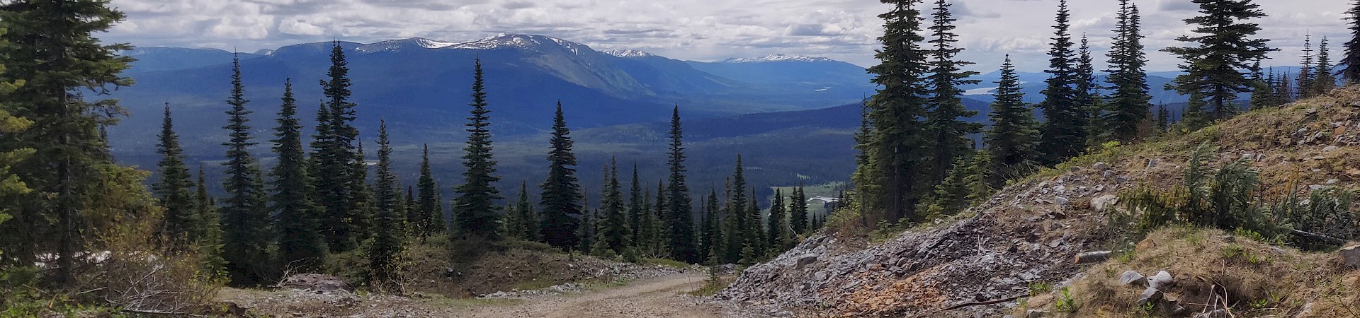
The CR property (GOLD) was staked by Eastfield Resources Ltd. in 2014 after a data search of the Wells-Barkerville area. The property is comprised of two mineral tenures covering an area of 927 hectares and is located approximately 80 km northeast of the town of Quesnel, BC and 20 km north of the historic gold mining towns of Wells and Barkerville. The project is 100% owned by Eastfield Resources Ltd.
A rush of exploration in Wells-Barkerville area during the 1980’s and 1990’s focused on the search for Besshi type VMS deposits in the Antler Formation of the Mississippian to Permian Slide Mountain Terrane. The Terrane is comprised of ophiolitic rocks, cherts and argillites, though locally felsic volcanics have been reported. This burst in exploration was in part fuelled by discoveries in Slide Mountain equivalent rocks of the Chu Chua deposits north of Kamloops and the Kudz Ze Kayah and Wolverine deposits hosted in felsic volcanics and the Fyre and Ice deposits hosted in mafic volcanics in the Yukon. The well-known placer (~4 million ounce production) and lode (~1.2 million ounce production) gold deposits of the Wells/Barkerville area are hosted within meta-sedimentary rocks of the Upper Proterozoic-Paleozoic Barkerville-Kootenay Terrane which structurally underlies the Slide Mountain Terrane.
Barkerville Gold Mines has a published resource (Beausolei, Pelletier, 2019) for the Cariboo Gold Project comprising: Measured + Indicated of 13,495,000 tonnes grading 5.6 g/t gold and inferred resources of 11,936,000 tonnes grading 5.0 g/t gold (on Nov. 21, 2019 Barkerville Gold Mines became a wholly owned subsidiary of Osisko Gold Royalties Limited). These massive pyrite lenses tend to occur on the flanks of vein systems where they cross-cut limestone and/or calcareous units and are considered to be replacement deposits. The gold quartz vein occurrences in the Barkerville Camp have been roughly dated as early Cretaceous, much younger than any of the host rocks in the region. These vein systems follow structural zones allowing their linear character and are associated, variably, with ankerite, pyrite, minor galena, sphalerite, scheelite, pyrrhotite, arsenopyrite, chalcopyrite and lead-bismuth sulphides. The veins have been noted to be associated with felsic intrusions. These intrusions occur as sills and dykes and varieties include quartz porphyry, felsite, aplite, and quartz latite. The intrusions are commonly strongly siderite/ankerite altered, pyritic and often show sericite alteration. The dykes also often carry low gold values.
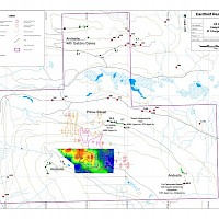
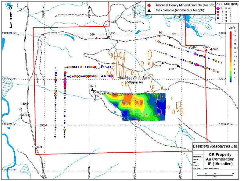
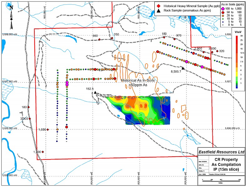
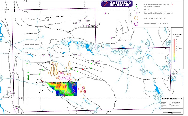
There is no record of hard rock mineral exploration on the CR property prior to Noranda carrying out regional exploration in the area in 1986 when they completed airborne magnetic and ground follow-up EM geophysical surveys, and soil sampling. Noranda followed up this work through 1989 with stream sediment, heavy mineral and soil sampling programs. Noranda identified a 1.2 kilometre by 0.7 kilometre arsenic in soil anomaly surrounding Arsenic Creek. Of note was the discovery on a number of logging road cuts and landings of chalcedonic quartz veinlets and vugs associated with red-brown weathered quartz-carbonate altered zones. Noranda also carried out a program of heavy mineral sampling along road cuts. Bulk samples were seived then pan concentrated to a small sample before analyzing. A number of highly anomalous gold samples were returned with values between 20 and 3300 ppb Au.
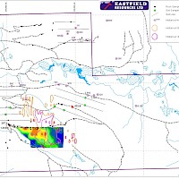
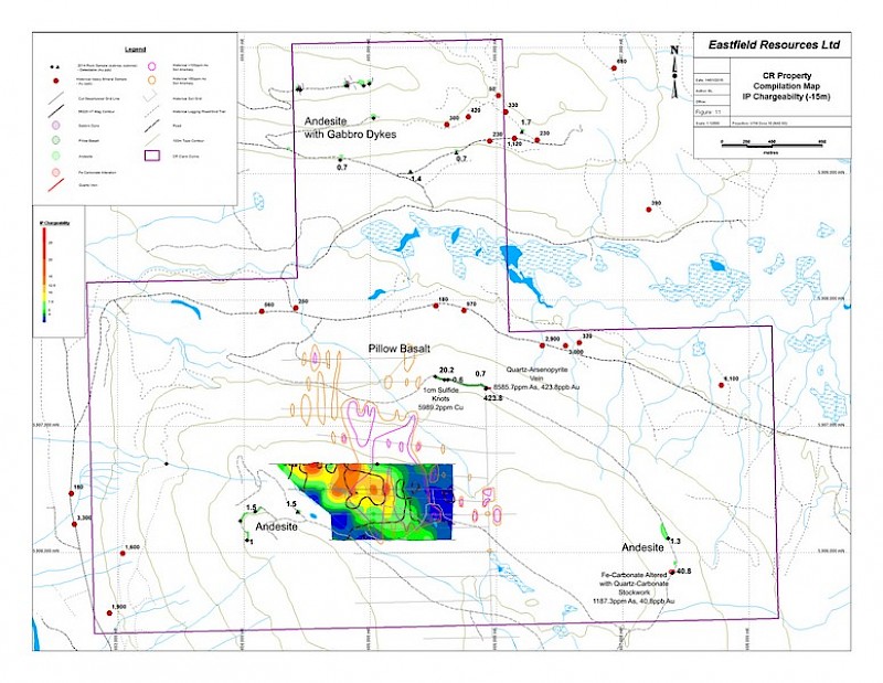
In 2014, Eastfield carried out a 4.8 kilometre Induced Polarization / Resistivity and Magetic surveys and an initial phase of prospecting and mapping. The IP survey outlined a 200 metre by 800 metre northwest trending chargeability high that remains open to the north. This anomaly occures at the highest edge of the arsenic soil anomaly and parallels topographic linears along the ridge top.
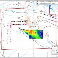
Prospecting and mapping to follow up and ground check anomalies discovered in previous work show the claim are to be underlain by Slide Mountain basalt to andesitic rocks locally cut by gabbroic dykes. The wallrock to the dykes often has stockwork of wispy sometimes vuggy white carbonate. A narrow very rusty weathering quartz arsenopyrite vein was discovered in a road cut approximately 650 metres northeast of the IP grid. A nearby outcrop of basalts contained one centimetre sulfide knots and veinlets returning 5989.2 ppm Cu. An iron carbonated altered and veined outcrop east of the IP anomaly returned 1187.3 ppm As with 40.8 ppb Au.
The 2018 program included soil sampling upslope of historical heavy mineral stream sediment anomalies and mapping and sampling of newly exposed road-cuts withinthe IP anomaly. The sampling discovered spot gold and arsenic anomalies that may indicate a source of the historical heavy mineral sampling.
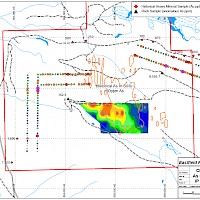
The 2019 program expanded on the 2018 soil sampling and included a grid on the north side of the project upslope of historical heavy mineral sampling.
The project requires further detailed exploration including expansion of the IP geophysical survey to delineate the full extent of the chargability anomaly, and widespread prospecting, geological mapping and sampling to search for sources of the large number of heavy mineral sites. Drill testing the IP anomaly is a high priority early in the exploration plan and is planned for summer 2022.